2025 North Greenland Windsled Expedition
In 2025 the North Greenland Windsled Expedition the team opened a new route, circumnavegated the Summit Dome reaching the east coast of Greenland and returning. The team sailed 1515 km in only 17 days.

On May 15th, the Windsled team arrived in Upernavik. After several delays and waiting periods, during which they unsuccessfully explored alternative overland access routes to the ice, the team finally flew by helicopter onto the ice sheet on May 26th. Following several days of preparation, the 2025 North Greenland Windsled Expedition officially set out on its mission on May 31st. The goal was to reach the east coast of Greenland and return to the starting point, circumnavigating the Summit Dome.
This journey had as its main objectives the opening of a new logistic network that could make possible the exploration of the full Northern Greenland ice plateau, with Upernavik as a strategic base for future zero-emission scientific/exploratory expeditions. The testing of the return route from the east coast was critical.
The team was composed of three experienced explorers: Ramón Larramendi, expedition leader and creator of the WindSled; Jens Jacob Simonsen, captain and polar logistics expert; and Antonio Mangia, guide and explorer.
The central challenge was to open the circumnavigation route map and validate a new route across the ice sheet that could serve future scientific missions. By doing so, the Windsled once again proved its value as a sustainable polar platform capable of supporting research and the collection of samples for climate and environmental studies. The goals were achieved after navigating 1515 km in 17 days, from May 31st to June 16th 2025.


The Journey in Four Steps
The expedition unfolded in four main phases:
- Sled Retrieval: The team first reached the sled’s overwintering location buried on the plateau. Surprisingly it was easily spotted and found in a perfect state, with a snow accumulation of 1.5 m. They dug it out completely in just 5–6 hours.
- Eastward Crossing: With favorable tailwinds, they pushed east toward the coast, making strong daily progress and covering 700 km in just 5 days on the northern side of Summit Dome — averaging 140 km per day — until they finally saw the first peaks of the east coast. The team passed very close to the EGRIP camp team, which was being moved to Summit Station.
- The Return: The most challenging leg — an 815 km push back west in 12 days, mostly navigating with crosswinds (lateral pull), which is far more demanding than tailwind navigation.
Through the southern side of Summit Dome, despite a three-day standstill due to calm weather, the team averaged 67 km per day on the return journey — and an impressive 95 km per day across the entire expedition. On one particularly intense day, they covered 270 km in 16 hours without stopping, battling strong winds and steering a 100 m² kite at the limit of controllability — a true test of skill and endurance.
- Opening of descent land route to the coast from Windsled camp. The Windsled team built a small and ultralight windsled of barely 3 m. With it they navigated some 70 km until encountering a large and dangerous crevasse field. Then the team was picked up from that spot being able to observe the correct land route to the coast, once in Upernavik they went by boat to the entrance point on the ice to explore the surface route onto the ice from the coast. The surface route from sea to Windsled camp is open, though not yet done. What is critical for the establishing of Upernavik as a North Greenland Windsled Hub.
A Platform for Polar Science

Even if this expedition was mostly a logistical challenge, the team collaborated with two major research institutions: the National Research Council of Italy (CNR-ISP) and the University of Maine (USA). As they traversed the ice, they conducted atmospheric sampling and snow stratigraphy studies, gathering data that will be used to analyse the evolution of polar snow layers, the transport of airborne particles, and long-term climate dynamics in the Arctic. These indicators are crucial for understanding both local and global impacts of climate change.
This successful mission confirms that wind-powered exploration is not only technically viable but also essential for the future of sustainable polar science.
Team
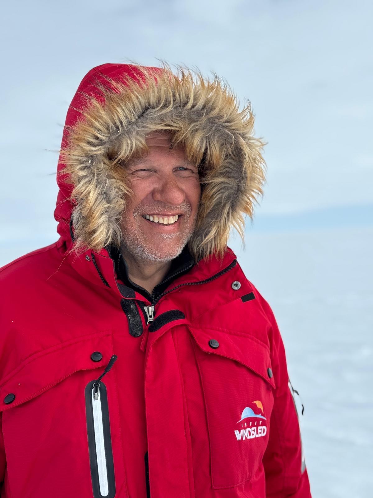
Ramón Larramendi
Project Leader
Greenland, Spain.
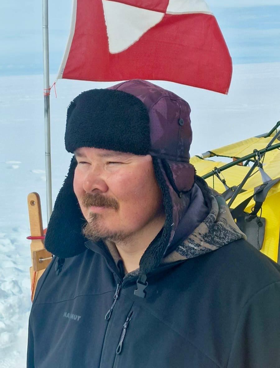
Jens Jacob Simonsen
Captain, Explorer, Polar Logistics
Greenland
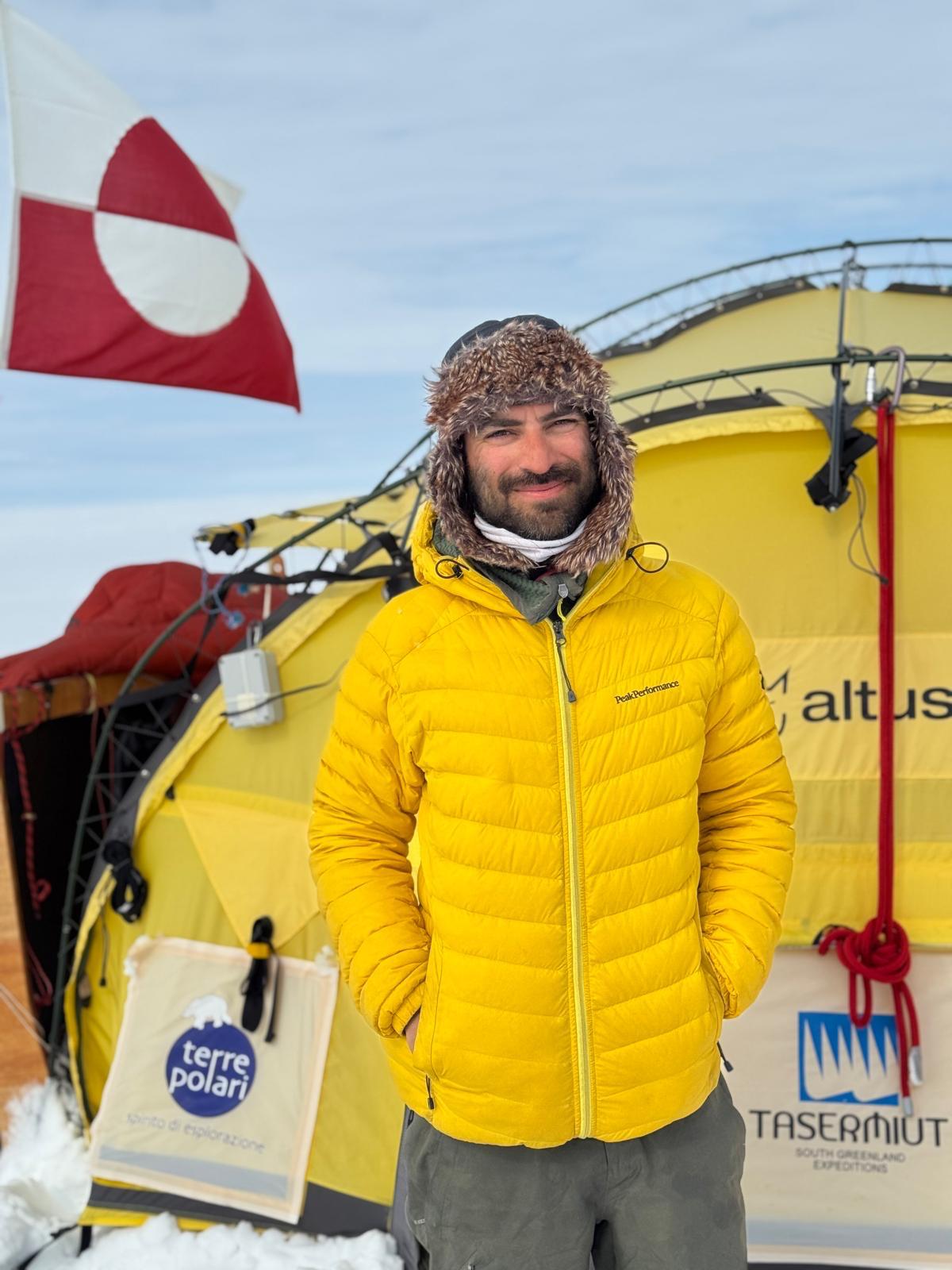
Antonio Mangia
Guide
Italy
Diary
Below you’ll find the personal journal of Antonio Mangia, an experienced guide who joined the Windsled Expedition for the first time. In it, he shares everything he experienced during this adventure, from moments of logistical organization and hard teamwork to times of fun and scientific collaboration alongside the University of Maine and Italy’s CNR-ISP.
As well, don’t miss out: download and discover everything in one place!
(English version)

Gallery
Scientific Projects
Scientific Projects conducted during the North Greenland Windsled Expedition 2025
University of Maine, USA:
Lead researchers: Professor Paul A. Mayewski and Ligia Naveira, PhD
During the 2025 NGWE (North Greenland WindSled Expedition), we supported the University of Maine’s Climate Change Institute in collecting and preserving surface snow samples from remote, high-elevation regions of the Greenland Ice Sheet.
This work builds on a larger PFAS study in Greenland, where the teams have been conducting a large-scale assessment of PFAS across the ice sheet and coastal regions. Preliminary results indicate that short-chain PFAS, which are highly mobile in the environment, were predominantly detected in surface snow and surface waters from the Greenland Ice Sheet, as well as in West and South Greenland. These findings highlight the efficiency of atmospheric transport and wet deposition in delivering global contaminants to the Arctic.
In the 2025 NGWE expedition, we continue this line of research by targeting three major groups of atmospheric pollutants:
- PFAS (per- and polyfluoroalkyl substances), linked to industrial emissions, global distribution, and potential ecological and human health impacts.
- Trace elements, including heavy metals and rare earth elements, are measured at ultra-trace levels using ICP-MS.
- Major ions, which act as tracers for marine aerosols and anthropogenic sources, help us interpret atmospheric transport patterns.
These snow samples offer insight into how pollutants accumulate at the interface between the atmosphere and the cryosphere -and how the Greenland Ice Sheet, which has historically served as a reservoir for anthropogenic pollution, may also act as a reservoir for PFAS.
By capturing these early indicators of contamination in one of the world’s most remote and climate-sensitive regions, this research contributes to our understanding of long-range pollutant pathways and their potential impact in a warming Arctic.
CNR – Institute of Polar Sciences, Italy
Lead researcher: Federico Dallo, PhD
Environmental monitoring is essential for understanding climate change and human impacts on ecosystems. Measurements from remote and hard-to-reach areas are particularly valuable, as they provide insights into background pollutant levels and atmospheric transport mechanisms.
The mini-PIONEER is a compact, low-cost instrument designed for easy deployment in remote environments to measure concentrations of fine particulate matter. Equipped with internal GPS and onboard memory, it was selected for the Inuit WindSled Project, where the main objective is to evaluate its ability to operate and collect data under extreme conditions.
A year ago, during the previous WindSled 2024 Greenland South North mission, a larger and more robust system was successfully tested. This year, the focus is on miniaturization, developing a lighter, more portable version without compromising performance.
If the mission proves successful, it could pave the way for the development of low-cost sensor networks with enhanced telecommunications, improved data quality, and wide-ranging applications.
These networks may support scientists, inform policy decisions, and empower citizens engaged in environmental monitoring, as well as enable other potential uses such as early warning systems for wildfire detection.